

SITE ANALYSIS
Buffer Zone Permits
Activities in the Buffer Zone
The Buffer Zone exists to prevent renewed hostilities between the opposing forces in the Cyprus conflict. While Cyprus has been peaceful for a long time, shots are sometimes fired into the bufer zone. In addition, thousands of land mines still lie dormant between the de facto ceasefire lines. That is one reason UNFICYP doesn’t allow any activity within the buffer zone without prior approval, except within specially designated Civl Use Areas. Safety and the operational requirements of UNFICYP come first, allowed by adherence to ownerhsip rights of the land within the buffer zone.
In order to manage activities within the buffer zone, INFICYP’s civil Affairs Branch manages four permit schemes: for construction, farming, work and access. All permits have a limited duration and permit hodlers must apply for renewal prior to expiration of the permit.
ATHIENOU
Established in 1928
Area: 6.413,83 hectares
Population: 5,000
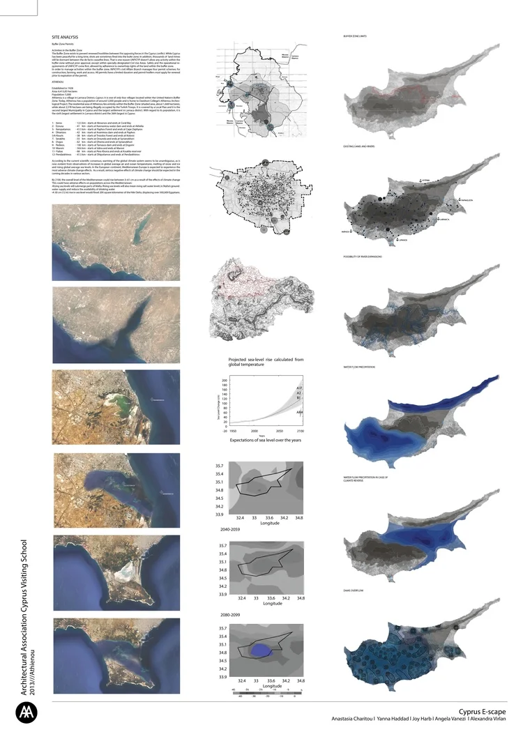
Athienou is a village in Larnaca District, Cyprus. It is one of only four villages located within the United Nations Buffer Zone. Today, Athienou has a population of around 5,000 people and is home to Davidson College’s Athienou Archeological Project. The residential area of Athienou lies entirely within the Buffer Zone (shaded area, about 1,668 hectares), while about 2,578 hectares are being illegally occupied by the Turksh Troops. It is covered by a Local Plan and it is the second largest Municipality in Cyprus and the largest settlement in Larnaca district. With regard to its population, it is the sixth largest settlement in Larnaca district and the 26th largest in Cyprus
1- Xeros - 12.5 km - starts at Akoursos and ends at Coral Bay
2- Ezousa - 41 km - starts at Kannavirou water dam and ends at Akhelia
3- Xeropatamos - 41.5 km - starts at Paphos Forest and ends at Cape Zephyros
4- Dhiarizos - 42 km - starts at Araminou dam and ends at Paphos
5/6-Kouris - 38 km - starts at Troodos Forest and ends at Kolossi
7- Serakhis - 55 km - starts at Orounda and ends at Syrianokhori
8- Ovgos - 62 km - starts at Dhenia and ends at Syrianokhori
9- Pedieos - 100 km - starts at Tamasos dam and ends at Engomi
10- Maroni - 34.6 km - starts at Valva and ends at Maroni
11- Yialias - 88 km - starts at Pera Khoria and ends at Kouklia reservoir
12- Pendaskhinos - 41.5 km - starts at Dhipotamos and ends at Pendaskhinos
According to the current scientific consensus, warming of the global climate system seems to be unambiguous, as is now evident from observations of increases in global average air and ocean temperatures, melting of snow and ice and rising global average sea levels. In the European continent, Mediterranean Europe is expected to experience the most adverse climate change effects. As a result, serious negative effects of climate change should be expected in the coming decades in various sectors.
By 2100, the overall level of the Mediterranean could rise between 3–61 cm as a result of the effects of climate change This could have adverse effects on populations across the Mediterranean:
•Rising sea levels will submerge parts of Malta. Rising sea levels will also mean rising salt water levels in Malta’s groundwater supply and reduce the availability of drinking water
•A 30 cm (12 in) rise in sea level would flood 200 square kilometres of the Nile Delta, displacing over 500,000 Egyptians.